


blah blah blah
Peboamauk Fall
Length: 4.2 miles out-and-backDifficulty (click for info): Moderate
Elevation Gain: 320 feet (+420 feet on return)
Rating (click for info): 6/10
Height: 30'
Source: Moose Brook
Driving Directions:
Trailhead is on Randolph Hill Road in Randolph, NH. From the top of the hill on Rt. 2, 3.5 miles west of the western junction with Rt. 16 in Gorham and 9.0 miles east of the junction with Rt. 115, turn north onto Randolph Hill Road. Drive 1.2 miles up the hill to a point beside an open field. Park on the opposite side of the road from the driveway to house #260, where there is a large barn in front. Click here for a Google map.
About the Hike:
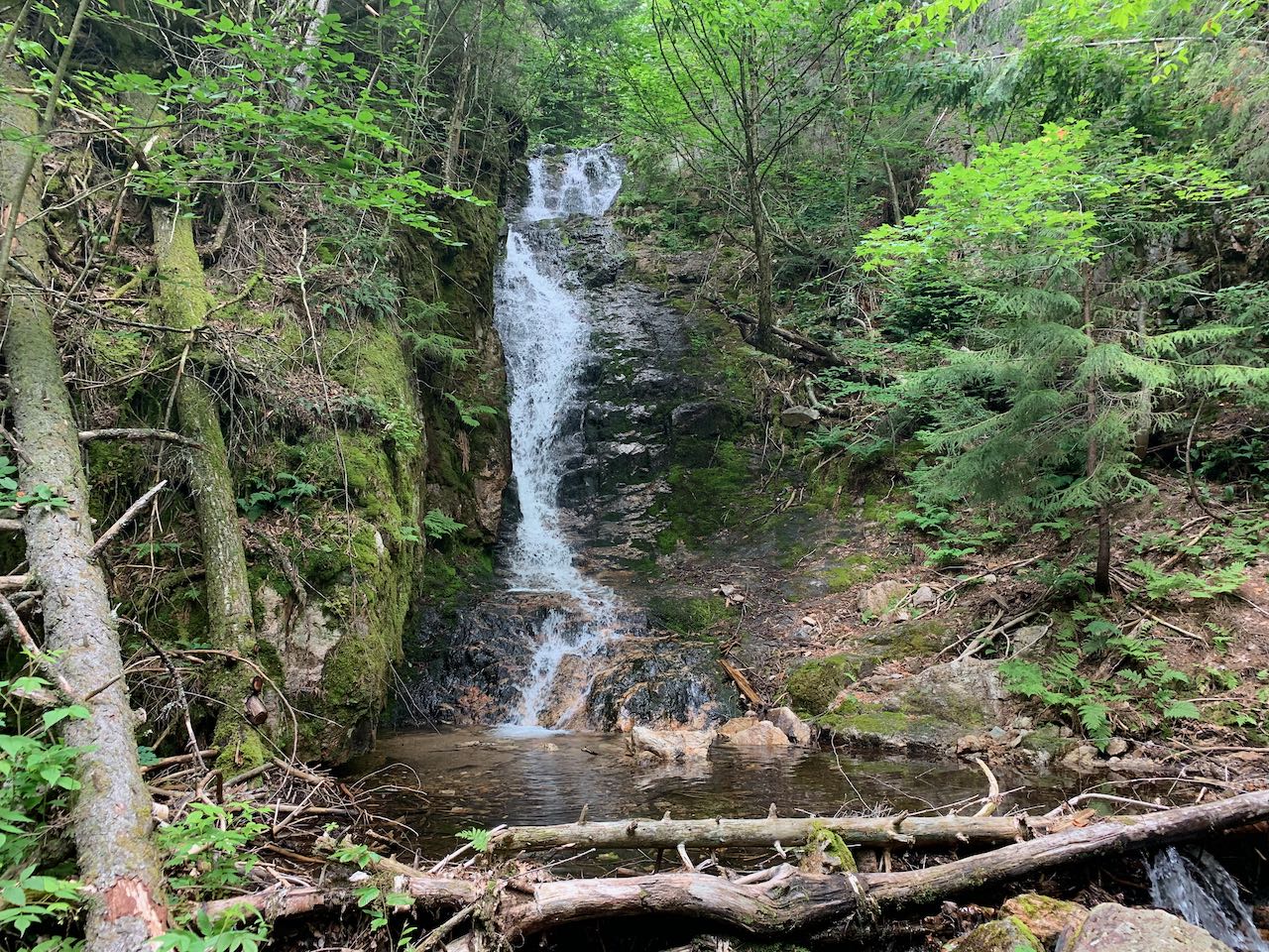
The mountain pass in the Crescent Range known as Ice Gulch is notorious for having one of the most difficult hiking trails in the White Mountains; in fact, it's what gives Ice Gulch any name recognition at all. The ragged notch, loaded with sawtoothed boulders and concealing year-round ice pockets in the shadows, attracts hikers to experience the trek through it - with all the appeal of a natural tourist attraction like the Polar Caves, but with no entrance fee and no safeguards. However, since the notch is mostly known for the Ice Gulch, the far easier and more accessible waterfall below the gulch gets mostly overlooked. For hikers who aren't interested in pushing the limits with a wild excursion of grappling over and crawling through jagged boulders, Peboamauk Fall offers a nice taste of the scenery. The 30-foot high cascade in a lush and mossy environment, the evocative name of which means "Winter's Home", carries in part the effluent melting ice and snow from the gulch for much of the year.
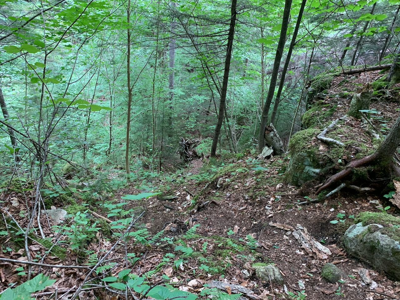
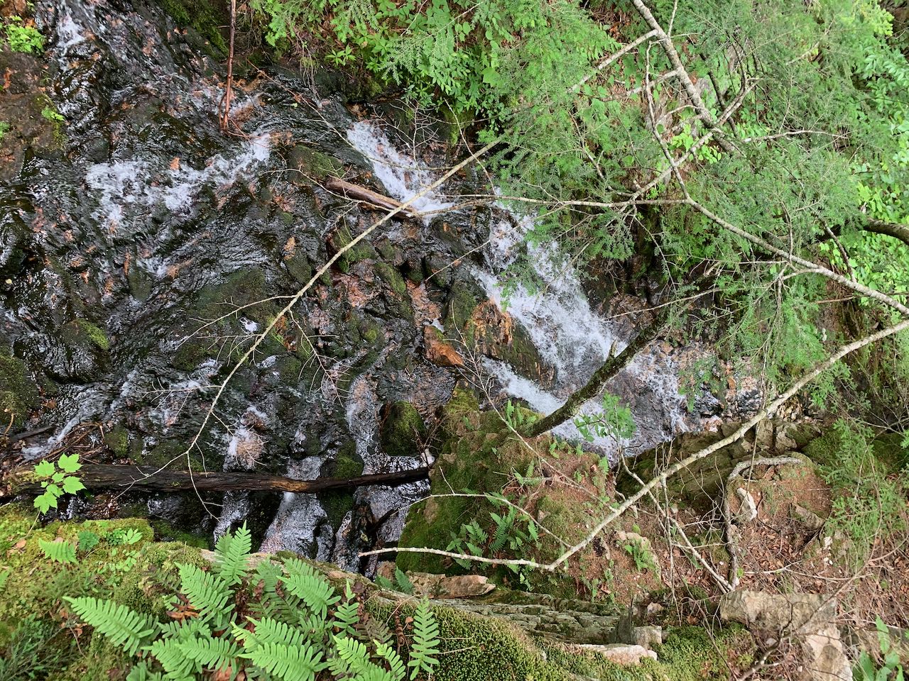
Begin your hike at the indistinct Ice Gulch Trailhead on Randolph Hill Road, where there is a nice view across the open field to Mts. Adams and Madison. Walk down the dirt driveway on the left side of the barn (marked with a sign across the stone wall). As you pass by the house, bear left off the driveway and walk toward the woods, where you'll see the trail entrance by a small trail marker on a tree. The trail descends through a mixed-wood forest at gentle grades, entering into the Randolph Community Forest. After 0.45 miles, the trail crosses the first of many small brooks. None are difficult crossings, all with easy stepping stones. Coming into a brighter, more open forest, the trail crosses another small brook and grassy Jimtown Logging Road in 0.2 miles. Continuing accross the hillside, with more rocks around the trail, the next brook crossing is reached after 0.3 miles more. The trail takes a very straight course across the lower slopes of Mt. Crescent, paralleling one of the logging roads uphill. The terrain remains mostly easy as the next brook crossing comes after 0.45 miles beyond the last one. The trail now begins to climb moderately. Another crossing follows after 0.2 miles, another 0.15 miles after that, and finally the trail descends 0.15 miles to a junction where the main Ice Gulch Path turns left uphill. Bear right onto Peboamauk Loop as it continues for 0.1 miles to the falls, descending down a very steep embankment. Use caution as you climb down to the brook, as footing may be loose. The falls come into view as you reach the brook, and the trail approaches the falls through streamside vegetation. Peboamauk Fall cascades down a smooth, mossy ledge ramp, walled in by rock on one side. The brook exudes extra cool temperatures all around it. At the base of the falls is a small, sandy pool. The Peboamauk Loop continues up the steep hillside next to the falls, offering a view down on the falls from above, if you wish to make the effort. Beyond the falls, it continues upward to rejoin with Ice Gulch Path as it heads into the Ice Gulch.
Printable directions page